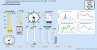
Weather Forecast
Discussion
219
FXUS64 KOUN 030346
AFDOUN

Area Forecast Discussion
National Weather Service Norman OK
1046 PM CDT Thu Apr 2 2026

...New AVIATION...

.KEY MESSAGES...
Updated at 1040 PM CDT Thu Apr 2 2026

- Cold front brings potential for strong to severe storms and
  locally heavy rainfall late Friday into Saturday.

- Dry conditions and cooler temperatures are expected Sunday and
  into middle of next week.

&&

.NEAR TERM...
(Rest of today and tonight)
Issued at 1230 PM CDT Thu Apr 2 2026

Surface observations currently show the moisture gradient tightening
along an axis of dilatation extending away from the surface low
pressure in Iowa. As the daytime progresses, the dry airmass will
mix a little further east. The "dryness" of the air will be
tempered some by the widespread rain footprint from yesterday which
will introduce at least some latent heating into the equation,
particularly further south and east where spring green-up is
underway.

The cumulative effect of this is that we anticipate a rather limited
spatial window for truly elevated fire concerns. A portion of
northwest Oklahoma (Woods/Harper/Woodward/Ellis Counties and parts
of their immediate neighbors) missed out on rain and will see
elevated fire weather this afternoon. However, slackening winds
during the minimum-RH period suggests that conditions will fall
short of needing a Rangeland Fire Danger statement.

As is usual this time of year, winds will shift to southerly right
after sunset. This will allow the moist airmass to wash back over
much of the area overnight and keep low temperatures in the 60s.

Meister

&&

.SHORT TERM...
(Friday through Saturday night)
Issued at 1230 PM CDT Thu Apr 2 2026

Primary short-term hazard will be one or two rounds of storms from
tomorrow afternoon through Saturday morning. Severe weather is
probable although the overall "ceiling" for severe impacts looks
rather low, and heavy rainfall is expected.

Tomorrow morning, another surface low will develop across Kansas as
a compact trough ejects further north. Given how compact the wave
is, height falls will be replaced by height rises quite rapidly
across the Front Range and High Plains in the afternoon and evening.
That will begin the process of accelerating a strong cold front
southward where it will meet the antecedent moist airmass in
northern Oklahoma. Two distinct waves of storms are possible:

1) A round of storms kicked off by a subtle wave in the STJ well
ahead of the cold front. Multiple members of the 12Z guidance suite
depicted this, including the HRRR, 3km NAM, and members of the MPAS.
Moderate instability and weak low-level/deep-layer shear should
cause those storms to grow upscale into clusters or a line segment.
The damaging wind risk will be tempered some by deep saturation
within the profiles, but very heavy rain and lightning are likely,
along with some damaging wind gusts from rear inflow jets or water-
laden downbursts. These storms will progress eastward during the
evening across the southern 2/3 of the area.

2) A round of storms kicked off late in the evening and lasting
through the rest of the night as the cold front pushes southward.
Given the north-south sink of the front, this round will feature
anafrontal convection with individual cores moving closer to due
east. However, with shear profiles enlarging, some organization to
individual updrafts is possible with 1-2 inch hail and damaging
winds possible.

Perhaps the biggest potential impact tomorrow night will be when
the footprint of storms in regime 2 overlaps with the footprint of
storms from regime 1. With PWATs surging over 1.5 inches, it
seems likely that some areas (right now central Oklahoma looks
likeliest) will see 2-4 inches of rain. Urban flooding and perhaps
a few cases of flash flooding are possible.

The storms will end from northwest to southeast early Saturday
morning as the frontal lines moves out. Behind it, expect clearing
skies and a beautiful Saturday afternoon with temperatures in the
60s.

Meister

&&

.LONG TERM...
(Sunday through Wednesday)
Issued at 1244 AM CDT Thu Apr 2 2026

Mid-level ridging sets up to our west and a surface high will
provide for beautiful weather conditions on Easter Sunday with light
winds, mostly sunny skies, and temperatures rising into the upper
60`s to mid 70`s.

Dry conditions are expected through middle of next week with high
temperatures remaining in the 70`s.

&&

.AVIATION...
(06Z TAFS)
Issued at 1040 PM CDT Thu Apr 2 2026

MVFR conditions will expand across much of the area overnight
into Friday. LLWS is also expected to affect the northern half of
the area through early Friday morning. Numerous showers and
thunderstorms are expected tomorrow afternoon through the
remainder of the period. A cold front will sweep through the area
starting tomorrow afternoon and advancing southward through the
night.

&&

.PRELIMINARY POINT TEMPS/POPS...
Oklahoma City OK  65  79  49  63 /   0  70  90  20
Hobart OK         63  83  47  69 /   0  60  80  10
Wichita Falls TX  66  82  52  69 /   0  70 100  30
Gage OK           59  80  41  68 /   0  10  30   0
Ponca City OK     62  79  44  63 /   0  70  70  10
Durant OK         67  82  53  66 /  10  60 100  60

&&

.OUN WATCHES/WARNINGS/ADVISORIES...
OK...None.
TX...None.
&&

$$

NEAR TERM...04
SHORT TERM...04
LONG TERM....01
AVIATION...13
NWS OUN Office Area Forecast Discussion


