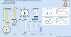
Weather Forecast
Discussion
151
FXUS64 KOUN 140730
AFDOUN

Area Forecast Discussion
National Weather Service Norman OK
230 AM CDT Tue May 14 2024

...New SHORT TERM, LONG TERM...

.SHORT TERM...
(Today and tonight)
Issued at 226 AM CDT Tue May 14 2024

Quiet weather? After the last few weeks of activity, we`re as
surprised as you are, but the short-term period really does feature
no meaningful chances for precipitation and no frontal passages. It
will be a touch warmer today than yesterday, especially out west
where winds will return to southerly as weak lee troughing returns.
It should otherwise be another beautiful afternoon with abundant
sunshine and highs in the low-to-mid 80s.

A weak wave will eject into the central Plains tonight, with
precipitation chances increasing mostly across Kansas. There is a
weak signal for some of those showers and storms to get into north
central Oklahoma just before daybreak tomorrow. Otherwise,
another quiet evening is expected with lows dropping to around 60.

Meister

&&

.LONG TERM...
(Wednesday through Monday)
Issued at 226 AM CDT Tue May 14 2024

We can`t stay quiet forever, especially in the month of May. West-
southwest flow up to 40 knots at 500 mb will overspread the region
on Wednesday, with another one or two subtle wave ejections
promoting the development of a surface trough across western north
Texas up to a weak surface low in northern Oklahoma. Within this
region, some compressional heating will produce one of the warmer
days of the year so far, with highs potentially reaching 90 as far
north as Alfalfa/Grant Counties. The complicating/mitigating factor
for this will be the expected development of precipitation within
the peak of the diurnal cycle. HREF guidance is really cueing in on
southwest Oklahoma and western north Texas as the likeliest location
for this diurnal convection as the dryline pushes east. Marginal
boundary layer moisture and some capping will inhibit the threat
from reaching a higher level, but 1,500 J/kg of MLCAPE and a dry
layer should lead to some damaging wind potential.

Further storm development is likely Wednesday night along the
surface trough/weak front, which will likely have a tendency to get
shunted southeastward overnight by convection. This will place the
greatest chance for storms further to the south and east by daybreak
Thursday. Redevelopment of storms is probable Thursday afternoon,
and by then greater surface moisture could lead to another severe
threat.

Beyond Thursday, the forecast looks to dry out again for the next
several days. We might get another one of those beautiful May days
on Friday with highs hanging out around 80. Following that, the
subtropical ridge looks to amplify from Mexico into the southern
Plains for the next several days, so we`ll likely see another
stretch of temperatures from the upper 80s to low 90s for the
weekend and into early next week.

Meister

&&

.AVIATION...
(06Z TAFS)
Issued at 1028 PM CDT Mon May 13 2024

Mostly clear skies are expected now with light winds, generally
from the northwest overnight. There is some potential for fog in
southeast Oklahoma, including KDUA, but the probability currently
looks too low to mention. Winds in the west will become southerly
during the day tomorrow.

&&

.PRELIMINARY POINT TEMPS/POPS...
Oklahoma City OK  81  60  86  63 /   0  10  30  60
Hobart OK         84  60  89  61 /   0  10  40  80
Wichita Falls TX  84  62  90  64 /   0   0  20  60
Gage OK           86  57  87  56 /   0  10  30  80
Ponca City OK     79  57  85  62 /   0  20  30  80
Durant OK         82  60  88  67 /   0   0   0  20

&&

.OUN WATCHES/WARNINGS/ADVISORIES...
OK...None.
TX...None.
&&

$$

SHORT TERM...04
LONG TERM....04
AVIATION...26
NWS OUN Office Area Forecast Discussion


