Stillwater UV Index Forecast
(UV forecast courtesy of and Copyright © KNMI/ESA (http://www.temis.nl/). Used with permission.)
UV forecast: Jun 09 2026 is 10.9 Very High
UV forecast: Jun 10 2026 is 10.3 Very High
UV forecast: Jun 11 2026 is 10.9 Very High
UV forecast: Jun 12 2026 is 11.9 Extreme
UV forecast: Jun 13 2026 is 10.2 Very High
UV forecast: Jun 14 2026 is 10.5 Very High
What is the UV Index?The UV Index provides a daily forecast of the expected risk of overexposure to the sun. The Index predicts UV intensity levels on a scale of 0 to 11+, where 0 indicates a minimal risk of overexposure and 11+ means a very high risk. Some exposure to sunlight can be enjoyable; however, too much could be dangerous. Overexposure to the ultraviolet (UV) rays of the sun radiation can cause immediate effects, such as sunburn, and long-term problems, such as skin cancer and cataracts. The UV Index, which was developed by the National Weather Service and the U.S. Environmental Protection Agency (EPA), provides important information to help you plan your outdoor activities to prevent overexposure to sun rays.
|
|
| UV Index | Category | Sunburn Time |
| over 9 | extreme | less than 15 minutes |
| 7-9 | high | about 20 minutes |
| 4-7 | medium | about 30 minutes |
| 0-4 | low | more than 1 hour |
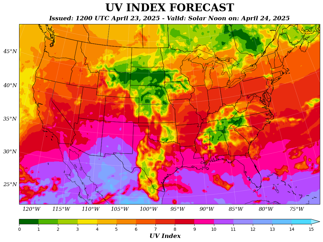
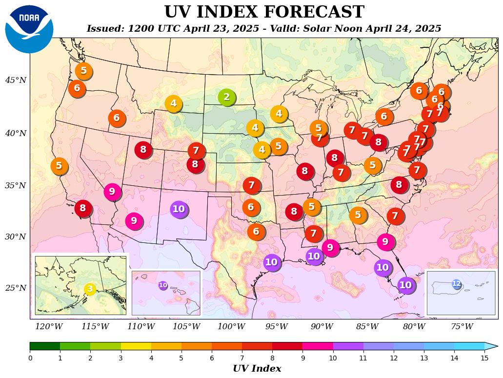
National UV Index